


Главное меню
Вы здесь
Часть карты района горы Иремель


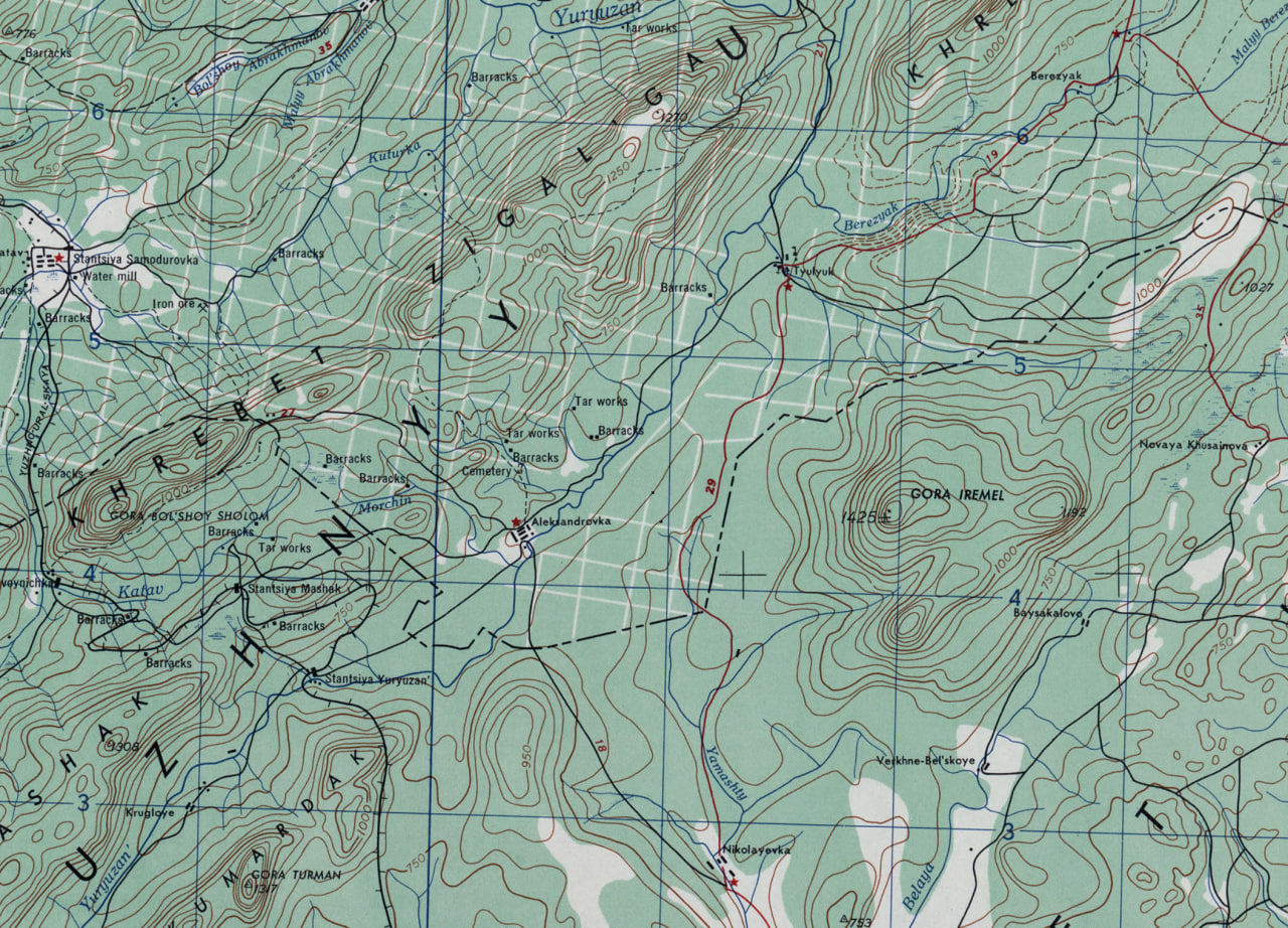
Prepared by the Army Map Service (TVS&H), Corps of Engineers, U. S. Army, Washington, D. C. Compiled in 1953 from: U.S.S.R., 1:200,000, General Staff of the Red Army, Sheets N-40-VI-W, 1938, and N-40-IX-E, 1936; U.S.S.R., 1:200,000 General Staff of the Red Army, Sheet Kataysk Rayon, 1936; U.S.S.R., 1:500,000, General Staff of the Red Army, Sheet N-40B, 1938. Miscellaneous detail added from: U.S.S.R., General Staff of the Red Army, 1:500,000, Political and Administrative Map of Kazakh SSR, 1950; 1:100,000, Sheet N40.34, 1938; 1:150,000, Sheets Satkin Rayon and Zlatoust Rayon, 1936; 1:50,000, Sheets N-40.48-B and D, 1926. Names transliterated in accordance with rules of the U. S. Board on Geographic Names. Road classification should be referred to with caution. The reliability of vegetation information is undetermined. Names for symbolized populated places are omitted where information is not available or where density of detail does not permit their inclusion.
Комментарии
Прикольно. Ощущение, что на Иремель посмотрели чисто из Тюлюка, оттуда же и Бакты не заметили.